- Details
Detailed itinerary
Itinerary- Tour Includes/Excludes
- Useful Info
- Trip Map
- FAQ
Trip overview
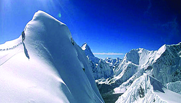
Mount Makalu is the fifth-highest mountain in the world which lies at 8,463 meters (27,820 ft). It is one of the most challenging mountains in Nepal and it is situated on the Nepal-Tibet border. The place is called Mahalangur, and this place is 19 km northeast of Everest and Kanchenjunga. The mountain’s name was most likely derived from the Sanskrit word Maha-Kala, which means “big black” and is a by-name of Shiva, one of Hinduism’s most important gods.
The shape of Makalu Mountain is like a pyramid which makes it more unique, attractive, and challenging. The majority of climbers are able to ascend Makalu in both the spring and fall. But especially in the spring season, it is the best to climb because of the good weather.
From Kathmandu to Tumlingtar, we take a domestic flight to start our Mount Makalu climbing excursion (45 min). Through the flight, you can experience scenic views and gleaming mountain beauty. We begin our ascent above the Arun River valley after landing at Tumlingtar Airport. it will take 25 minutes of flight journey. We pass through Sherpa villages and green woods, which will lead us to beautiful local settlements. Likewise, the point offers a scenic view of Mount Chamlang and the Himalayan view. From here, we carefully ascend to the hanging icefall at 6,100 meters, to the right.
Makalu South East Ridge:
Makalu base camp (5600M)
The base camp is the first point where we set up the tent. The trail to Makalu base camp is full of the rocky moraine with a shiny and gleaming view of the Himalayans. After the long trek to base camp, you will be fully served hot beverages and warm snacks. Before starting our further journey, we will do puja as per Nepalese culture, which is a way of collecting good luck for a successful journey.
Makalu Camp 1(6400m)
After receiving and reviewing the climbing training, you will be ready to climb Camp 1. The whole Makalu Camp is divided into two sections: one is the lower camp and the other is the upper base camp. The distance between the two is 100m (328 ft).
Makalu Camp 2 (7450m)
The climb from Makalu base camp 1 to camp 2 required an average level of technical climbing skills. The trial allows you to encounter many ice areas that require a ladder, rope, and climbing techniques to climb smoothly.
Makalu Camp 4 (7900m)
The distance between camp 3 and camp 4 is comparatively short, but this walk might be tougher because of the lack of oxygen at higher altitudes. In particular, in the winter the risk of climbing is high because at that time entire hills and land are covered with snow.
Makalu Summit (8485m)
Though the walk from camp 4 to Makalu summit requires only 4 hours, you need to be physically and mentally ready for the dangers and other obstacles that might make your walk tougher. If you want to get back to camp 3 for a night’s stay, then you must walk an extra 2 hours from camp 4 to reach there.
Highlights:
- Climbing Mt. Makalu, the fifth-highest mountain in the world (8463m),
- Beautiful pictures of Mt. Shishapangma to the west and Kanchenjunga to the east.
- Makalu Barun National Park exploration
- The scenic flight from Tumlingtar to Kathmandu and back to Tumlingtar
- The chance to practice with seasoned climbers
- The Nepalese folks have fantastic hospitality.
- Investigating the voluminous cultural heritage of the Gurung, Rai, Sherpa, and Bhotia communities
Itinerary
Day 1: Entry into Kathmandu (1350m).On the first day, our representative will be there for you to receive, and he/she will drop you off at the hotel with all your luggage. You get a warm welcome and delicious Nepali cuisine for dinner.
As per the package, you visit the most famous sights in Nepal, including Basantapur Durbar Square, Bhaktapur Durbar Square, and Patan Durbar Square.
From Swayambhunath's mountaintop, we can see an incredible sunset over the Kathmandu valley. We go back to the hotel in the evening and spend the night there. The following day, we will get ready for the show. We finish all the essential paperwork and legalities.
It is a two-hour trip from the airport to Manebhanjyang village. We will take a flight from Kathmandu to Tumlingtar after an early breakfast.
The Manebhanjyang communities are inhabited by the Rai and Gurung people. We begin our walk to Manebhanjyang after registering at the national park checkpoint. We stayed the night at a neighborhood inn after reaching Manebhanjyang village.
After having a warm breakfast, we start our day with a small hike. As we go, we will see more of Tibetan tradition and culture in local settlements. The journey continues along a short crest. We continue to Bhotebas, at 1740 meters, and then ascend a little pass. We can see Makalu Himal in all its glory in the pass. To get to the settlement of Kuwapani, we travel through a thick forest.
We will continue on the trail from Kuwapani to the crossing of another minor mountain, Daju la pass, which is at 2100 meters. From the peak of the hill, you have a stunning view of the entire area.
We make a sharp descent toward a historical woodland before reaching the Num village. We'll set up camp at the village's campground. At the tent camp, we spent the night.
After having an early breakfast, we leave our camp at the nun's village and go down to the Arun Khola bridge. After crossing the suspension bridge, we start a difficult ascent through a forested area until we reach Seduwa village.
Seduwa has a national park check post office and is a large trading village. We travel to the campsite and set up our tent for the day, after completing a few requirements.
We follow the simple track that passes through the Murmidanda after an early breakfast. Our route climbs a hill as we approach Narbugaon. As we continue our ascent toward Tashigaon, we pass through extensive forests and agricultural areas.
Since the trail passes through isolated places, Tashigaon is the last town along it. If required, all the things should be purchased here. Our camps will be established in Tashigaon.
We continue our trip as we ascend sharply towards Unshisha.
We spent the night camping in Kongma. There is camping available, and tea cafes are only open during the busiest times. We keep going till we find a decent camping spot.
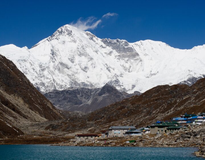
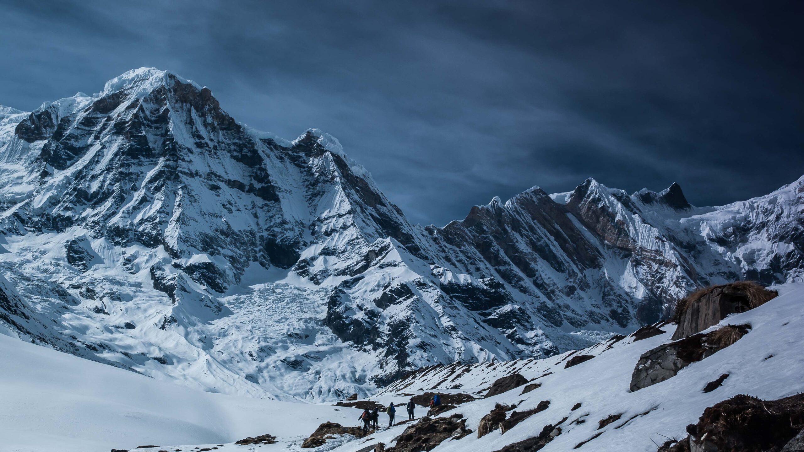
From Kongma, we continue our hike across the stunning Kongma La Pass. We are treated to spectacular views of Makalu, Barun Tse, Chamlang, Kanchenjunga, Jannu, and other snow-capped mountains at the top of the pass.
We carry on hiking until we reach the Tutu La Pass. From there, we make our way downwards to Sano Pokhari Lake. We located a decent campsite close to the lake. We stay in a tent camp while admiring the stunning night sky.
We begin our walk to the Keke la pass after an early breakfast. The pass's summit may have fantastic views of the Chamlang range. We stop and rest to renew ourselves.
We descend the pass in a steep, rocky manner. We reached the village of Mumbuk after about 4 hours of hiking. In Mumbuk, we spend the night in a camp.
We eat breakfast early before beginning our day's adventure. The trail's initial descent reaches the Barun Nadi Riverbanks. We return up the steep mountain from the Barun Nadi riverbed.
The region damaged by the landslide is visible along the hills. While traveling through these places, you should use extreme caution. We reach Yangle Kharka's verdant fields after nearly four hours of hiking via shaky routes over the Barun Nadi.
Starting in the direction of Langmale Kharka, we hike through thick rhododendron, fir, and pine forests. From there, we go into Barum Nadi and across an old lateral moraine.
The valley is filled by the glacial lake on the left. The trail then meanders along until it approaches the Hillary Base Camp. We arrive at the Hillary Base Camp after an almost six-hour hike.
After breakfast, we head toward Makalu Base Camp early in the morning. The path takes a right turn and then ascends beside the moraines. We cross a short bridge and gradually descend to the stone cottages of Makalu Base Camp after reaching the top.
The snow-covered mountains are seen in all their splendor. We will set up the camps at various levels with the assistance of the Sherpa team. In Makalu Base Camp, we unload our belongings and set up tent camp.
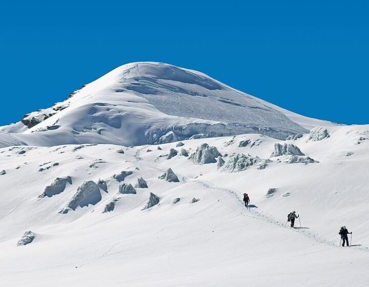
We prepare to climb the magnificent Makalu Mountain for more than two weeks while acclimatizing. We will build up the camps at several locations with the assistance of the professional sherpa staff. We also inspected the various climbing tools and supplies we brought for the hike.
The team leader's directions and directives are followed by us. On the ascent, we also put a number of tough portions to practice. The fifth-highest peak in the world is called Makalu. So, scaling the mountain requires tremendous dedication.
On level land, at the top of the glacier, is where we put up our first camp. The journey across the difficult path to Camp II will take about 4 hours. The tour may be challenging due to sporadic snowfalls in the region.
The journey from Camp II to Camp III is quite straightforward and less difficult. Camp III and Camp IV are separated by a wide traverse and zigzag slope. The adventure is led by seasoned climbers who instruct us with their knowledge. Rope repair is also required in a few places.
We take some time to take pictures and create memories before heading back to the base camp. The fantastic sherpa team assists us in setting up camps and providing wholesome meals for the trip.
From the peak's summit, we can observe stunning scenes covered in snow and summits like Mount Everest, Lhotse, Nuptse, Cho Oyo, Barun Tse, and Manaslu, among others.
We spent one more day at the base camp, cleaning up after ourselves. Our tour is environmentally friendly and carbon neutral. As a result, we will carry all the rubbish with us until we identify a suitable location for waste management.
We also pack away the climbing gear and tools we utilize following a day of cleaning and packing. Under the Sherpa tradition, we will offer a prayer to the mountain gods for a successful ascent of Mt. Makalu.
We leave for Yak Kharka early in the morning. The descent is a simple path.
At Yak Kharka, we pitched our tents for the night. Residents plan a unique ceremony. We spent the evening singing and dancing to folk songs with the locals.
After spending a lovely evening and enjoying traditional dance and taking part in it, we packed our belongings and departed the village of Mumbuk. We resumed our trip along the same route that brought us to Tashi Gaon village. At Tashigaon, we spent the night in a tent camp.
After breakfast, we depart Tashigaon as the trail winds through the hills' alpine trees. The trail then travels through Narbugaom's farmed fields.
After leaving Narbugaon, we descend sharply till we reach a flat trail that takes us to the Seduwa trading village. We stopped at Seduwa and ate lunch. After leaving Seduwa, we cross the Arun Nadi and make a steady ascent to the town of Num. We spent the night in Num at a camp.
We set out on foot for the steep stretch of the dense woodland after leaving the Num settlement. We travel there via the little pass of Daju la, at 2100 m. Then we hike to Kuwapani Village.
Magnificent views of Mt. Makalu greet us as we arrive there. We continue our ascent toward the Chichiri. In the Chichiri settlement, we spend the night in a lodge.
After breakfast, we begin our trip through the lovely Mane Bhanjyang villages in order to reach Khandbari. While at Khandbari, we stopped and ate lunch.
After that, we make one last journey from Khandbari to Tumlingtar. It takes 5 to 6 hours to complete the walk. We spend the night at Tumlingtar in a lodge.
After an early breakfast, we take a lovely flight from Tumlingtar to Kathmandu. You will be taken to the hotel after your arrival in Kathmandu, which takes around 45 minutes. You are welcome to stroll through the city at night. You'll spend the night at the hotel.
On your hands, we have one extra day. You may take a city trip to view the sights. Earlier, it wasn't possible to see every monument in the town; here is your chance. Additionally, you could shop for trinkets on Thamel's streets.
The Thamel neighborhood is renowned for its vibrant nightlife. Thamel has an endless supply of bars, cafes, pubs, and nightclubs where you can unwind. Many handicrafts and regional goods are ideal for bringing home as souvenirs. The hotel is where you'll spend the night.
An employee will pick you up from the hotel and drive you at airport.
Included
- Permit for Mount Makalu Expedition Climbing
- KTM-Tumblingtar-KTM flight ticket
- Sherpa climbing experience: 2:1
- The purpose of all transportation expeditions.
- Airport pick-up and drop-off.
- Everything in the kitchen.
- High-altitude tents for high-altitude camps.
- Base camp has a private tent with a mattress.
- Tents for dining, kitchens, and toilets
- Except for personal climbing gear, everything necessary climbing equipment is provided.
- The number of porters required to transport the load and member baggage.
- Porter's gear throughout the expedition
- All employees have insurance.
- During the excursion, all meals are provided for members and crew.
- Individual package food and high altitude dry foods of great quality.
- Base camp Gamow/PAC bag
- Everyone should have a first-aid kit.
Not Included
- Medical insurance for high-risk patients
- Fees for visas and visa extensions
- Persona climbing gear
- Climbing sherpa summit bonus
- Mineral water, alcoholic beverages, and phone calls
Useful Info
- For your safety, insurance is highly recommended.
- Makalu Expedition is the ideal choice for experienced,
- We suggest only the highest quality equipment on the market.
- We attend to the specifics of your excursion to ensure that you are both comfortable and healthy.
- To give maximum flexibility, our climber is accompanied by a Sherpa climbing guide.
- Keep all necessary kit/equipment for climbing as discussed and mentioned by the professionals.
- Our Sherpa Climbing Guides have climbed many 8000-meter peaks.
Trip Map

FAQs
-
What did I need to get a Nepal visa?
One passport-size photo with a light background and a valid passport The size of the passport-size photo has not been set by the Immigration Department. Visa can only be obtained in the following currencies: Euro, Swiss Franc, Pound Sterling, US dollar, Australian dollar, Canadian dollar, Hong Kong dollar, Singapore dollar, and Japanese Yen. Visa fees cannot be paid with a credit card, Indian cash, or Nepalese currency.
-
Is credit card payment accepted in Nepal?
AMERICAN EXPRESS, VISA, and MASTERCARD are accepted in major hotels, restaurants, and curio shops. For credit card services, you can contact the banks.
-
What is the best time to visit Nepal?
Nepal can be classified into three zones based on elevation: the high mountains, the mid-hills, and the flat Terai plains. Mountain trekking sites such as Everest, Langtang, and Annpurna remain cool all year. Except for the summer months of May to July, the mid-hills, including Kathmandu and Pokhara, are cool. During the summer, temperatures in these cities remain significantly lower than in many other cities in the region. In the Terai plains, Lumbini, Chitwan, and Janakpur are hot in the summer (March-July) but frigid in the winter (December-February). If you want to go trekking, the best months to go are September to November and February to May, when the weather is nice during the day and the temperatures do not drop dramatically at night.
-
Is travel insurance required for trekking in Nepal?
If you become ill or have an accident while trekking, helicopter services are available. Such rescue services, however, are costly. As a result, extensive travel insurance is recommended to cover emergencies such as helicopter rescue and medical treatment.
-
Is an airport tax levied in Nepal?
Yes. Your ticket already includes it. However, a separate airport fee of Rs. 200 is levied before boarding on domestic flights.